Linear Referencing System (LRS) for the Caltrans highway network to meet HPMS requirements
Challenge Caltrans needed to build a linear reference systems (LRS) to support upcoming federal Highway Performance Monitoring System (HPMS) requirements. They asked Farallon to recommend a plan to pilot development for five counties in the Sacrmento area, to meet the new HPMS standards. HPMS is a federally mandated inventory system and planning tool designed to […]
Nature Conservancy eCatch Version 2.0 – iOS

Challenge The Nature Conservancy (TNC) developed eCatch, a web-based application to monitor, visualize, and georeference catch limits and depleted species using data collected by fishing vessels. This catch data was entered into a geodatabase. With the advent of eCatch, a new digital fishermen’s logbook system was created where different fishing parties could upload and share […]
CalTrans: LD-IGR – Geo-based Project Tracking System
Challenge Development projects such as housing subdivision, commercial parks, and others can result in significant impact on portions of the State’s transportation system. In order to foresee and mitigate these impacts, Caltrans provides review of development proposals from local agencies (such as city and county governments) through a division of its Office of Planning called […]
Deploying ArcGIS Portal and Your First Web Applications with the LGIM
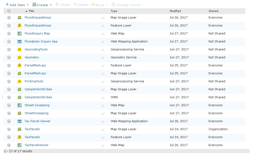
If your organization is looking to upgrade your GIS system and create customized online workflows to query, manage or share your data, Esri LGIM and its template applications should not be overlooked.
Use your mobile phone to find the best fishing hotspots near you

Farallon Geographics partnered with ReelSonar to create NetFish, a social mobile app available that uses GIS and asset database to guide anglers on when, where and what fish to catch on waterways near them.
Port of San Francisco Uses Enterprise GIS to Prepare for Sea Level Rise Caused by Climate Change

Like many coastal cities, San Francisco is developing Sea Level Rise Action Plan to prepare for sea-level rise as a result of climate change. The Port of San Francisco, located on the water, is inherently more vulnerable than any other piece of infrastructure. The Port of San Francisco is working with Farallon Geographics to develop an […]
Integrate Historic Maps, Modern Aerial Imagery and Shapefiles in Arches v4 to Understand Cultural Significance
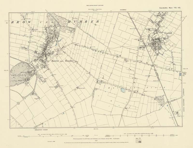
Working with Historic England, we use Arches v4 to integrate and compare the vast archive of historic maps for the the City of Lincoln with modern aerial images to better understand cultural significance.
What Does Storytelling Have to Do with a GIS Strategic Plan?

A GIS Strategic Plan is a way to understand the unique story of a client and turn that story into a script for action. Elements of good storytelling can play a key role in developing a robust GIS Strategic Plan. Hero, setting, quest, antagonist and plot all play a role.
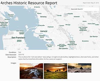
How to Create Resources in Arches 4 Cultural Heritage Management Software
Quick walkthrough for developers on how to model and create data in Arches 4. This step-by-step shows designing Branches and Resource Models all the way through collecting and reporting on Resource data.
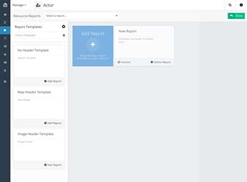
Arches 4 Lets Developers Create Custom Reports for Cultural Heritage Management
Report templates in Arches 4 will make building Arches reports easier than ever. Developers can use the templates to suit a custom use case around reporting and build better custom reports with less time and effort.
