If you’re an avid reader of the Farallon blog you have no doubt noticed our series of posts on Esri’s LGIM. See for example: Esri’s LGIM competes with customized GIS solutions for using geodata in local government.
As those posts note a migration from a legacy system to LGIM is non-trivial, but made far easier with Farallon’s ETL workflows.
What Do You Gain When You Migrate Your Data to the LGIM?
In this post, I would like to focus on some of the features you gain once you’ve migrated your data to the LGIM.
Data Sharing via Portal for ArcGIS
When an organization approaches us with the intention of upgrading to the LGIM we often recommend implementing both ArcGIS Server and Portal for ArcGIS. ArcGIS Server allows an organization to publish their own GIS services which can be consumed by end users or business applications like TRAKiT, EnerGov, Accela, or Greenview. Portal is mainly an interface for end users allowing them to access data from your ArcGIS server through a tidy non-intimidating (and customizable) web interface where they can create their own maps and apps to suit their particular needs (more on this later). Of course, access can be granted to users outside your organization making it easier to share data between a city and its corresponding county for instance. It’s easy to think of Portal for ArcGIS as your organization’s self-hosted ArcGIS Online instance.
Create and Style Your Own Maps for Applications
Portal for ArcGIS with the LGIM also allows users to create and style their own content. Consuming services from your ArcGIS Server instance users can create their own maps that can be published publicly, just within your organization or just for themselves. These maps can be created by anyone that has the permissions to access the data published by ArcGIS Server. And that permission can be controlled by the original data publisher.
Many Applications Can Be Up & Running Quickly
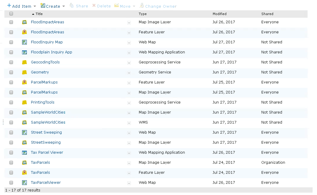
Best of all, Portal and ArcGIS Server along with the LGIM come with applications that can be easily deployed ‘out of the box’. Now I know we’ve mentioned this in previous posts, but I’d like to dive into it a little bit deeper here. Parcel management, identification, and reporting is a consistent need Farallon sees from local municipalities. Someone always wants to gather information about a parcel or group of parcels. They often would like to gather this information quickly (sometimes while on the phone with a client) and the information being requested can change from call to call. To solve this need, the LGIM comes with a Tax Parcel Viewer application.
Example: Tax Parcel Viewer Application
With the help of ArcGIS Server for publishing services from your organization’s LGIM database, Portal for ArcGIS for distributing these services across your organization, and Portals ability to create maps that can be consumed by applications, your organization can have the Tax Parcel Viewer application running within a matter of hours. Basemaps and feature layers can be customized, along with popups, labels and reports, even helpful widgets like geocoders and measurement tools can be added, removed or modified, all making this generic ‘out of the box’ application specialized for your data, your users and your needs.
The Tax Parcel Viewer is only one example of the many application templates the come included with the LGIM. A more complete list can be found on the Esri ArcGIS gallery. Some of my favorites include the Parcel Notification App, and the Floodplain Inquiry App. In addition, with more sophisticated data comes more sophisticated apps like the Stormwater Viewer, My Elected Representative and 3D Public Survey.
LGIM Offers Great Value Without the Need for a Dedicated Web Developer
If your organization is looking to upgrade your GIS system with the eventual goal of publishing your data online or creating customized online workflows to query or manage your data the LGIM and its template applications should not be overlooked. They can provide great value for an organization without the time or resources to retain a dedicated web developer. The LGIM solutions are many in number and relatively easy to deploy and customize. For more information about migrating your data to LGIM or deploying some of its many included customizable web applications talk to an expert at Farallon today.


