City of Berkeley Enlists Farallon Geographics to Migrate to Esri LGIM and Leverage Off-the-Shelf Services, Applications and Workflows
Farallon Geographics worked with the City of Berkeley to efficiently migrate their GIS from a legacy data model to Esri’s “Local Government Information Model” (LGIM). Farallon delivered an ETL script, verified the integrity of the transformed data and deployed the populated LGIM database to the new server architecture and geodatabase.
Developers Can Add Their Magic to Arches 4 With Custom Widgets and Data Types
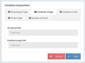
Arches 4 will allow everyday users to create graphs, forms and reports without having to write code. Developers can add their own additional magic using custom widgets and custom data types.
Geospatial Software Solutions Come and Go, Mind the Data!
As geospatial experts we need to ensure that our data can survive the software that we use to create, edit, and interact with it. But how do we do this? How do we build for data longevity?
Farallon Geographics Migrates City of Foster City to Esri LGIM for Easy Use of Off-the-Shelf Applications
Farallon Geographics is working with the City of Foster City to migrate their legacy GIS system to Esri LGIM. LGIM offers an affordable, forward-thinking solution that can access to a wide range of Esri and Esri-compatible COTS applications built for local governments
What is a GIS Strategic Plan and Template
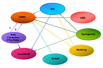
Writing a Strategic Plan gives me the opportunity to research the latest technologies, review what we’ve done for other clients and then weave that into an optimized, tailored solution for the client.
For Historical Preservation in Queen Anne’s County, It’s All About Connections
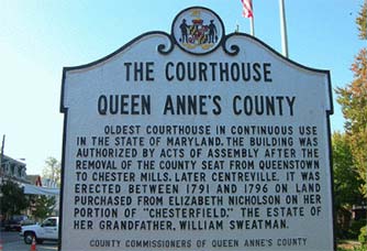
“The single biggest benefit for us with Arches is NOT the compilation of the inventory of people, properties, etc. It is the way Arches connects ‘all to all’ so that when you search for and retrieve one person or item, you get everything connected to it.”
Resource Graphs in Arches v4 Cultural Heritage Software
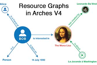
Creating and modifying resource graphs in Arches v3 required some technical expertise. But with Arches v4, using a simple interface, users can create completely new resources by selecting from a suite of graphs (each of which describes a set of related information, data entry forms, and report templates).
Want to get hands-on with Arches without installing any software?
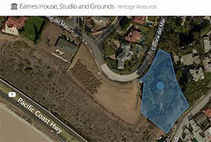
We work with the Getty Conservation Institute to create this Arches Demonstration Site to give anyone the opportunity to get a hands-on perspective of the Arches v3.0 platform without having to install the software.
How do you define significance in cultural resources management?
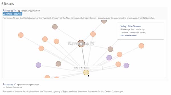
Cultural heritage requires a more sophisticated way of thinking about cultural significance. It’s not necessarily the object that matters, it’s the relationship of that object to other things that matters. This is how we designed Arches.
Geospatial tech to help art restoration, analysis and conservation
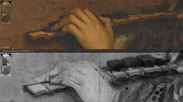
Farallon is working with the Getty Conservation Institute to develop a software platform to manage, integrate, discover, and use digital information for restoration, conservation and understanding of works of art.
