Challenge
The Nature Conservancy (TNC) developed eCatch, a web-based application to monitor, visualize, and georeference catch limits and depleted species using data collected by fishing vessels. This catch data was entered into a geodatabase. With the advent of eCatch, a new digital fishermen’s logbook system was created where different fishing parties could upload and share species catch information and data, innovating and enhancing modern fisheries management. However, TNC recognized that both the web application and its original program code were becoming outdated, rendering eCatch more difficult and costly to use and maintain.
Solution
For the development of eCatch Version 2.0, Farallon and TNC staff jointly defined the functional requirements of the new web-app, the specific technology components that would be used to build it, and the software environments that would be used to deploy it. To revitalize the web-app, Farallon designed and developed a new and more modern second-generation Apple iOS version of eCatch including upgrading the application and design from Apple iOS 6 to 7 and readily implement its features to ensure compatibility with iOS 7.
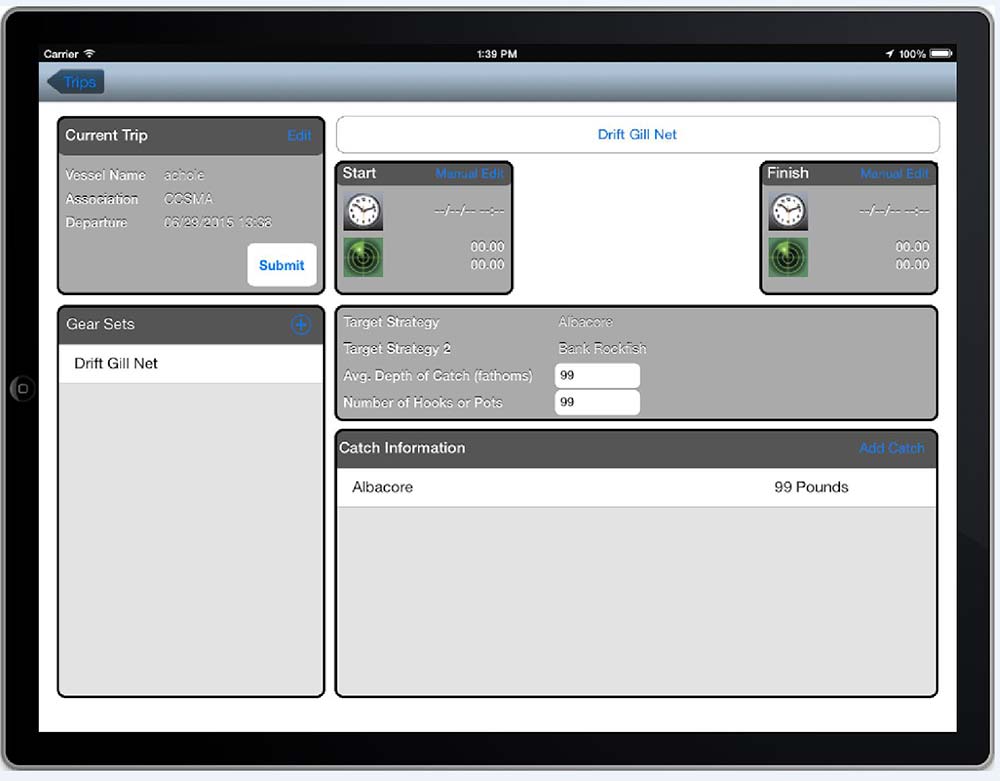
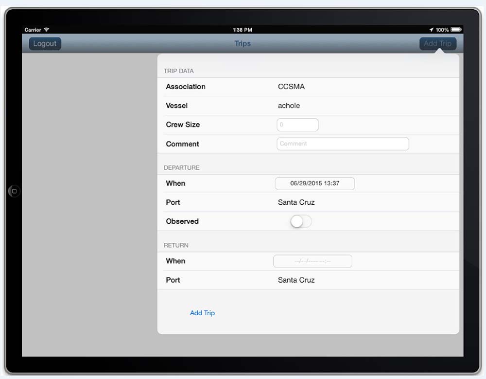
Farallon developed eCatch V2.0 to create an optimum and robust graphical user interface (GUI) to make querying, visualizing, and reporting fisheries data easier for fishermen. The update process for Apple iOS 7 included a formerly restricted manual editing feature for latitude and longitude coordinates. Accordingly, to promote data security, Farallon programmed necessary user authentication parameters. In addition, Farallon verified the applicability of the Dual GPS integration system, a brand of external antenna hardware used by the web-app to strengthen GPS signal to help foster quality data collection. To ensure the application met TNC’s needs, Farallon used an iterative development approach to provide regular opportunities to review and comment on the functionality of the new user interface throughout the build effort.
Special features of the new eCatch Version 2.0 include:
- Enterprise editing interface with review/audit hierarchy
- Easy-to-use Google Basemap integration
- Dual GPS Integration
- Ability to display data and history from all past trips with straightforward legend and symbology
- Easy-to-use search and navigation tools with new GUI
- Application will alert users of Overfished Species (OFS) catch events as soon as the data is entered into the system—compatible with eCatch Version 1.0 data entry module
- Easy management of user accounts for administrators i.e. adding new users and editing existing user information
- Effective security model to protect the geodatabase
Screenshots & Videos