Arches project has been accepted into Google Summer of Code!
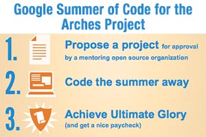
This year Farallon Geographics, the Getty Conservation Institute partnered to apply to Google Summer of Code for the Arches project. We’re excited to announce that we have been approved to be the mentoring organization! We are looking forward to an exciting summer with awesome contributions from students from all around the international community.
Using MS Access as the query interface to Oracle Spatial
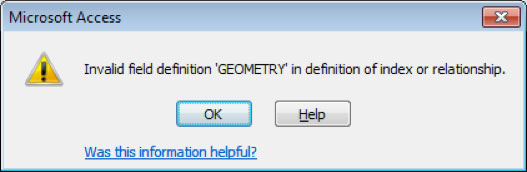
Being adept with MS Access means it was common practice for me to make ODBC links to my Oracle Spatial database, and use Access as the interface to do the actual querying. But when I try to link to a table that had a column of sdo_geometry datatype, I get an error.
Remodeling GIS Parcel Data for Ease of Use
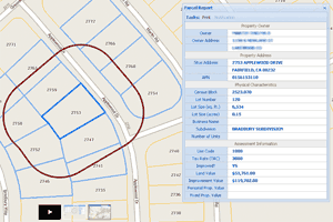
In GIS parcel layers, I find that users tend to assume that APN (assessor parcel number) represents a unique key for each parcel geometry in a County. Nine times out of ten, this assumption is wrong, and results in an inaccurate analysis. The best solution is to create a parcel layer in which APN is a unique key.
eCatch 2.0 – rebuilding sustainable fisheries on the California coast using GIS
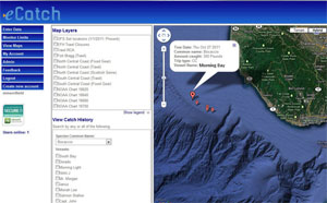
eCatch developed by The Nature Conservancy, gives fishermen real-time information to avoid overfished areas and locate more abundant species. eCatch 2.0 co-developed with Farallon will add a dynamic UI with enhanced mapping and analytic capabilities.
Software development iterations and data backup for GIS web applications: Part 1
Enterprise GIS web application development is about how to represent your existing data and how to capture new data. Here at Farallon, we have successfully built some very smart geospatial web applications that guide the user in that process. This post is about how we support the backing up of data for these advanced geospatial […]
Understanding the lingo of GIS

My blog is dedicated to those professionals (GIS and otherwise) who get blindsided by the GIS jargon of the day. Every time I hear a new word, I promise to post my working definition so that those who have better things to do than decode GIS jargon can move on with their lives. This week, I’m starting with an old favorite: the GIS Data Model.
