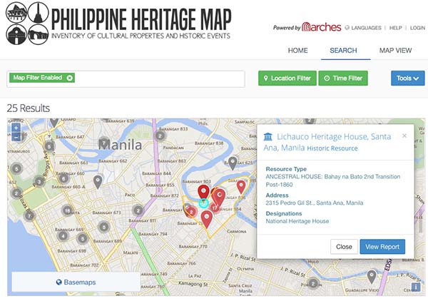
The Philippine Heritage Map is an inventory and management system for cultural properties and historic events around the Philippines. It is powered by Arches Heritage Inventory & Management System.
Developed by the Getty Conservation Institute and the World Monuments Fund with Farallon Geographics as the geospatial, UI and application design development team, the Arches project is an open source, web- and geospatially based information system designed to inventory and manage all types of immovable heritage, including archaeological sites, buildings, structures, landscapes, and heritage ensembles or districts.
As part of Arches v3.0 Farallon developed a fully responsive and mobile-friendly UI for use on desktop, tablets and smartphones. An interactive graph view of resource relationships makes it easy and fun to uncover relationships and patterns. It also incorporates full-fledged thesauri or almost any kind of controlled vocabularies (particularly important when searching for images), semantic ontology, graph database, elastic search and built-in mechanisms to enforce data standards.