Challenge
The California Emergency Management Agency (Cal EMA) needed to develop an in-house capability to quickly disseminate critical geospatial datasets and applications in support of its mission of statewide emergency mitigation, response, and recovery. To achieve that goal, Cal EMA needed to modernize its outdated GIS into a sophisticated Enterprise System and make the GIS function a core and vital service of its Information Technology Department.
Solution
Farallon evaluated Cal EMA’s existing GIS in relationship to its actual business needs and existing IT infrastructure in order to define the optimal EGIS architecture that meets critical business objectives and within agency IT policies and standards.
Cal EMA decided to use ESRI’s ArcGIS Server as its enterprise GIS platform. Farallon installed and configured the EGIS with the following attributes:
- Data is stored using OGC compliant formats,
- Security is managed using the Agency’s internal Active Directory framework, and
- Applications are built using standards-based services.
Farallon developed a data model that provides order and structure to the thousands of GIS layers that the Agency must warehouse for easy access when needed. Data sets to be included in the data model were identified collaboratively with Cal EMA staff and include the appropriate sources and updated workflows.
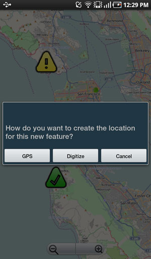
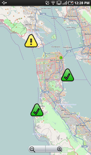
Farallon also developed a prototype Android-based mobile application that supported Cal EMA’s collection of real-time field data during an emergency training exercise as a test of the enterprise GIS architecture.
Farallon also developed a prototype Android-based mobile application that collected real-time field data during an emergency training exercise. The mobile application allowed responders to generate incident points, photos and validated attributes, which were in turn immediately available for display back at the emergency operations center. This prototype application validated the overall approach to the Agency’s GIS Architecture and created tangible business value from the important, but largely invisible investment in upgraded GIS technology.
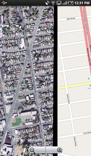
Lastly, Farallon developed a web-based GIS viewer that allows Cal EMA staff members and authorized stakeholders to easily visualize the location and extent on incident data such as location of wild fires, accidents or locations of swine flu outbreaks. The application blends Open Source technologies with the Agency’s ArcGIS Server to control costs and meet The Agency’s evolving technical requirements to be deployed in multiple environments and accessed via a web browser on a desktop, laptop, tablet or an Android or Blackberry handheld device.
Screenshots & Videos