Remodeling GIS Parcel Data for Ease of Use
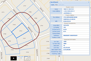
In GIS parcel layers, I find that users tend to assume that APN (assessor parcel number) represents a unique key for each parcel geometry in a County. Nine times out of ten, this assumption is wrong, and results in an inaccurate analysis. The best solution is to create a parcel layer in which APN is a unique key.
